A Reconnaissance survey, often referred to as a “recce survey” or “preliminary survey,” is an essential initial step in various fields, particularly in civil engineering, urban planning, and environmental science. This survey serves as a preliminary assessment to gather vital information about a site before any detailed planning or development work begins. It is designed to provide a broad overview of the existing conditions and potential challenges associated with the site, ensuring that subsequent detailed surveys and designs are informed and efficient.
What is Reconnaissance Survey
A reconnaissance survey is a vital initial step in planning and executing construction projects, especially in India. It provides a broad overview of site conditions, identifying key features, constraints, and opportunities that influence project feasibility and design. This quick, cost-effective assessment informs more detailed studies and aids in efficient decision-making and resource allocation.
In construction, these surveys assess physical, environmental, social, and economic characteristics. Engineering reconnaissance surveys evaluate topography, soil types, infrastructure, and drainage, which is essential for India’s varied landscapes. Environmental reconnaissance surveys identify vegetation, wildlife, water and air quality, and pollution sources, ensuring compliance with Ministry of Environment guidelines. Cultural reconnaissance surveys document archaeological sites, heritage buildings, and cultural landscapes, adhering to Archaeological Survey of India regulations. Economic reconnaissance surveys assess land value, businesses, and economic impacts, crucial in commercial hubs like Mumbai or Bangalore.
The process involves preparation, field visits, data analysis, and reporting. Preparation includes gathering data from maps and satellite imagery. Field visits involve site observations, sometimes using drones. Data analysis identifies key features and constraints, often using Geographic Information Systems (GIS). The final report summarizes findings and provides recommendations, including maps, photographs, and compliance requirements as per Indian regulations.
Reconnaissance surveys are indispensable for successful construction projects in India. They provide a comprehensive overview of site characteristics, enabling informed decision-making, efficient planning, and effective risk management, ensuring sustainable and compliant development in India’s dynamic landscape.
Types of Reconnaissance Survey
In the context of India and its diverse geographical, environmental, and socio-economic landscape, reconnaissance surveys play a crucial role in the planning and execution of construction projects. Here is a detailed explanation of the different types of reconnaissance surveys, specifically tailored for the Indian audience and related to construction:
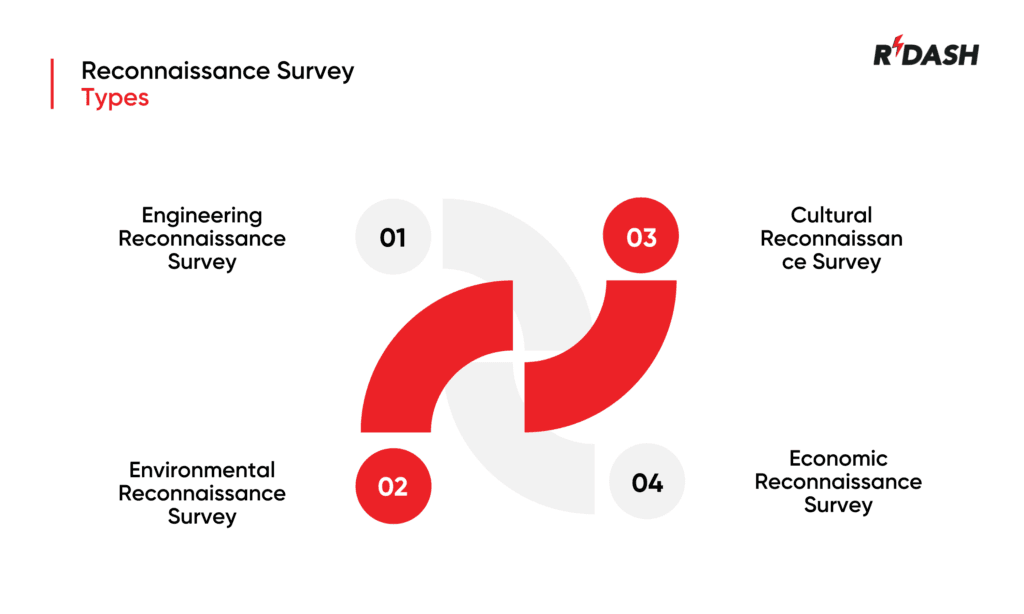
1. Engineering Reconnaissance Survey
Objective: To assess the physical and infrastructural characteristics of a site for construction projects.
Components:
- Topography: Mapping the terrain to understand elevation changes, slopes, and natural features. In India, this is particularly important due to the varied landscapes ranging from mountains to plains.
- Soil Analysis: Preliminary identification of soil types and their properties. For example, clayey soils in regions like the Gangetic plains or sandy soils in Rajasthan have different implications for construction.
- Existing Infrastructure: Documenting existing roads, buildings, utilities, and other infrastructure. This helps in planning access routes and understanding the potential impact on nearby structures.
- Drainage Patterns: Studying natural and artificial drainage systems to plan for effective water management, crucial in monsoon-affected areas.
Application:
- Planning road networks, bridges, and urban infrastructure projects.
- Assessing rural areas for development projects under schemes like Pradhan Mantri Gram Sadak Yojana (PMGSY).
2. Environmental Reconnaissance Survey
Objective: To identify environmental factors that could impact the construction project and ensure compliance with environmental regulations.
Components:
- Flora and Fauna: Identifying local vegetation and wildlife. For instance, the presence of protected species in areas like the Western Ghats can influence project planning.
- Water Quality: Assessing surface and groundwater quality, essential for projects near rivers like the Ganges or lakes.
- Air Quality: Baseline air quality assessment, important in urban areas with high pollution levels.
- Potential Pollution Sources: Identifying nearby industrial activities or waste disposal sites that could affect the project site.
Application:
- Obtaining environmental clearances as per the Ministry of Environment, Forest and Climate Change (MoEFCC) guidelines.
- Ensuring sustainable development in projects like the Smart Cities Mission.
3. Cultural Reconnaissance Survey
Objective: To identify and preserve historical and cultural features of a site.
Components:
- Archaeological Sites: Identifying and documenting any ancient structures or artifacts. India, with its rich heritage, has numerous such sites that need protection.
- Heritage Buildings: Cataloging historical buildings that might be affected by construction activities. For example, cities like Delhi and Varanasi have many heritage structures.
- Cultural Landscapes: Recognizing landscapes of cultural significance, such as traditional agricultural lands or pilgrimage routes.
Application:
- Ensuring compliance with the Archaeological Survey of India (ASI) regulations.
- Preserving cultural heritage during urban redevelopment projects.
4. Economic Reconnaissance Survey
Objective: To evaluate the economic aspects of the site and its surroundings.
Components:
- Land Value: Assessing current land values to understand investment potential and cost implications.
- Existing Businesses: Identifying local businesses and economic activities. This is important in commercial hubs like Mumbai or Bangalore.
- Economic Benefits: Evaluating how the project might boost local economies, such as creating jobs or improving infrastructure.
Importance of Reconnaissance Survey in Surveying
A reconnaissance survey holds paramount importance in the field of surveying, particularly in the context of construction projects in India. This preliminary survey serves as the foundation for all subsequent planning and development activities, ensuring that projects are well-informed, strategically planned, and successfully executed. Here’s a detailed exploration of its significance, specifically tailored to the Indian audience and construction industry.

Informed Decision-Making
One of the primary benefits of a reconnaissance survey is its role in informed decision-making. By providing a comprehensive overview of a site’s physical, environmental, social, and economic characteristics, it allows stakeholders to make educated decisions regarding site selection, project design, and resource allocation. For instance, understanding the topography and soil composition of a site in the hilly regions of Himachal Pradesh can influence the design and foundation of structures, thereby ensuring stability and safety.
Risk Mitigation
Reconnaissance surveys play a crucial role in identifying potential risks and challenges early in the project lifecycle. In India, where diverse climatic conditions and geographical variations exist, such surveys help in anticipating issues like soil erosion in coastal areas, landslides in mountainous regions, and flooding in flood-prone zones. Early identification of these risks enables the development of mitigation strategies, reducing the likelihood of project delays and cost overruns.
Environmental Compliance
In a country with rich biodiversity and stringent environmental regulations, reconnaissance surveys ensure that construction projects comply with environmental laws. By assessing factors such as local vegetation, wildlife habitats, water quality, and air quality, these surveys help in obtaining necessary clearances from the Ministry of Environment, Forest and Climate Change (MoEFCC). For example, a project near the Western Ghats, a biodiversity hotspot, would require a thorough environmental impact assessment to minimize ecological disruption.
Preservation of Cultural Heritage
India’s rich cultural heritage necessitates careful consideration during construction activities. Reconnaissance surveys help identify and document archaeological sites, heritage buildings, and culturally significant landscapes. Adhering to regulations set by the Archaeological Survey of India (ASI), these surveys ensure that construction projects do not harm historical and cultural assets. For instance, urban redevelopment in cities like Varanasi must account for its numerous heritage structures and sites of historical importance.
Economic Feasibility
Economic reconnaissance surveys evaluate land value, existing businesses, and the potential economic impact of construction projects. This is particularly relevant in rapidly developing urban centers like Mumbai and Bangalore. By assessing these factors, stakeholders can determine the economic viability of projects, forecast returns on investment, and plan for economic growth. This helps in aligning construction projects with broader economic development goals and local community benefits.
Efficient Planning and Budgeting
Reconnaissance surveys facilitate efficient planning and budgeting by providing an initial overview of the resources required for a project. In India, where infrastructure projects often involve significant public and private investment, accurate budget estimation is critical. Understanding the site’s characteristics helps in forecasting costs related to land acquisition, construction materials, labor, and mitigation measures. This ensures that projects stay within budget and are completed on time.
Streamlined Project Execution
By laying the groundwork for detailed surveys and studies, reconnaissance surveys streamline project execution. They provide a clear roadmap for subsequent phases, such as topographical surveys, geotechnical investigations, and detailed design work. This systematic approach minimizes uncertainties and ensures that construction activities are carried out efficiently and effectively. In large-scale projects like the Delhi-Mumbai Industrial Corridor, such streamlined execution is essential for timely completion and operational success.
What is a Field Reconnaissance Survey
A field reconnaissance survey is a critical preliminary step in the planning and execution of construction projects. It involves a thorough on-site inspection to gather essential data about the physical, environmental, and socio-economic characteristics of a potential project site. In the context of India’s diverse and complex landscape, a field reconnaissance survey plays a pivotal role in ensuring that construction projects are strategically planned, efficiently executed, and environmentally sustainable.
Objectives of a Field Reconnaissance Survey
The primary objectives of a field reconnaissance survey in construction are to:
- Assess Site Conditions: Understand the physical characteristics of the site, including topography, soil composition, vegetation, and water bodies.
- Identify Potential Constraints: Recognize any environmental, legal, or social factors that could impede project development.
- Evaluate Infrastructure and Accessibility: Examine existing infrastructure such as roads, utilities, and access routes to the site.
- Gather Preliminary Data: Collect initial data to inform detailed surveys and design processes.
Importance in the Indian Construction Industry
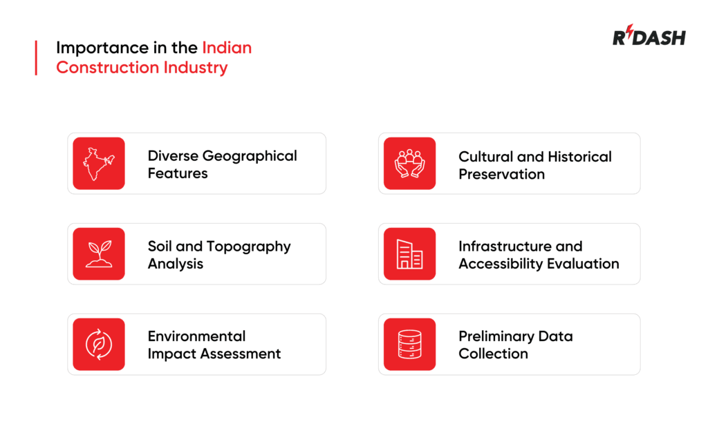
- Understanding Diverse Geographical Features : India’s vast and varied geography requires a detailed understanding of site-specific conditions. For instance, a construction project in the mountainous regions of Himachal Pradesh or Uttarakhand will face different challenges compared to one in the arid deserts of Rajasthan or the flood-prone areas of Assam and Bihar. A field reconnaissance survey helps in identifying these geographical nuances, allowing for tailored design and construction strategies.
- Soil and Topography Analysis : Soil composition and topography are fundamental factors influencing construction. In India, where soil types range from alluvial soils in the Gangetic plains to black soils in Maharashtra, understanding these characteristics is crucial. Field reconnaissance surveys involve soil sampling and analysis to determine bearing capacity, drainage patterns, and potential issues like soil erosion or landslides. This data is vital for designing stable foundations and effective drainage systems.
- Environmental Impact Assessment : Environmental considerations are paramount in India, given the country’s rich biodiversity and stringent environmental regulations. Field reconnaissance surveys help in identifying environmentally sensitive areas, such as protected forests, wetlands, and wildlife habitats. By assessing these factors early, construction projects can be designed to minimize ecological disruption and comply with regulations set by the Ministry of Environment, Forest and Climate Change (MoEFCC).
- Cultural and Historical Preservation : India’s rich cultural heritage necessitates careful planning to avoid damaging historical sites and structures. Field reconnaissance surveys identify and document archaeological sites, heritage buildings, and culturally significant landscapes. This ensures that construction projects adhere to the guidelines of the Archaeological Survey of India (ASI) and preserve the nation’s cultural legacy.
- Infrastructure and Accessibility Evaluation : Assessing existing infrastructure and site accessibility is critical for project logistics and planning. Field reconnaissance surveys examine current transportation networks, utilities, and access routes. This is particularly important in urban areas like Delhi, Mumbai, and Bangalore, where infrastructure constraints can significantly impact project timelines and costs.
- Preliminary Data Collection for Detailed Surveys : Field reconnaissance surveys provide the groundwork for more detailed geotechnical, hydrological, and environmental surveys. By gathering preliminary data, these surveys help define the scope and methodology for subsequent investigations, ensuring that they are focused and cost-effective. This step is essential for comprehensive project planning and budgeting.
Steps in Conducting a Field Reconnaissance Survey
- Preparation and Research: Gather existing data from maps, satellite imagery, and local government records.
- Site Visit: Conduct on-site inspections to observe and record physical, environmental, and infrastructural features.
- Data Collection: Collect soil samples, topographical measurements, and environmental data.
- Analysis and Reporting: Analyze the collected data to identify key characteristics and constraints. Prepare a detailed report with findings and recommendations, including maps, photographs, and compliance requirements.
Advantages of Reconnaissance Survey
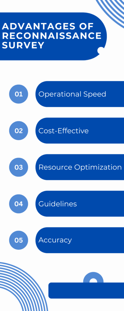
- Operational Speed: Reconnaissance surveys enhance the operational speed as they are completed before any other survey. This expedites the project timeline.
- Cost-Effective: These surveys prove cost-effective, saving resources that would otherwise be spent on redundant surveys.
- Resource Optimization: They efficiently save both money and time, optimizing resource allocation.
- Guidelines: They facilitate a better understanding of the project area by establishing guidelines in advance, reducing the likelihood of work-related errors.
- Accuracy: The accuracy and reliability of reports are ensured through various criteria, including the use of updated maps, data derived from topographic maps, and aerial pictures.
Disadvantages of Reconnaissance Survey
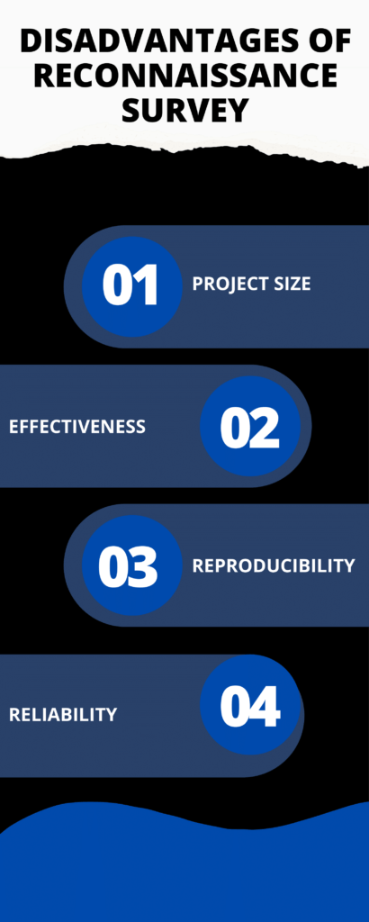
- Project Size: The project size may be larger than normal, necessitating more time and leading to increased expenses for completing all components.
- Effectiveness: These surveys are less effective than site-specific surveys, as previously surveyed regions cannot be utilized, requiring the survey and recording of new areas.
- Reproducibility: There is difficulty in reproducing existing road materials and standards for a project, contingent on the site’s discoverability.
- Reliability: The results may be unreliable due to changes in the region not captured in the initial survey, even if the area was thoroughly examined on-site.